Drone technology has the power to revolutionize how we work and live. From delivering packages to making the streets safer, we’ve only just started to see the impact drones will have in our daily lives.
One area where drones have already started to have a noticeable effect is in the surveying industry.
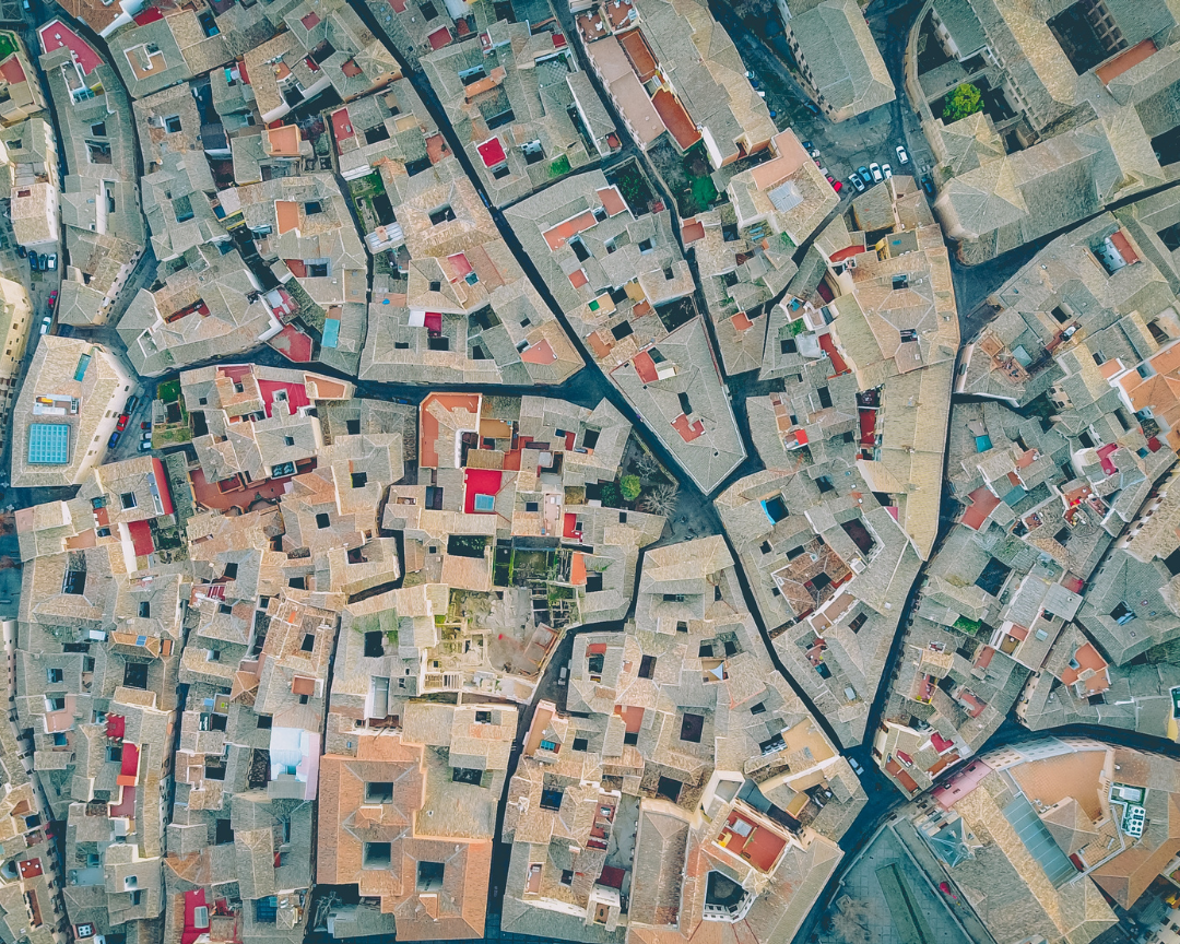
Drone mapping is an aerial method of topographical surveying. It uses drones to take photos from the air and then combines imaging data into a detailed 3D map using digital software.
Let’s take a sky-high look at drone mapping and learn how surveyors use this exciting technology.
Topography Mapping Via Drones
Drones need to be tough to perform in rugged outdoor environments. They must handle being out in the rain and sun for long periods of time. Drones and the attached camera equipment need to withstand hot and cold temperatures.
Drones used in mapping also need to perform multiple tasks while carrying a payload (any excess weight added onto the drone). Infrared drone cameras take photos at night, while high-definition cameras capture detailed images in natural light conditions.
Extended flight times require longer-lasting batteries so pilots don’t have to constantly stop to recharge. Drone speed and mobility allow pilots to cover large areas and maneuver into tight spaces. Unlike manned aircraft or conventional photography methods, drones present surveyors with a new world of opportunity.
Drone Mapping Software
Drones create maps using a process called photogrammetry. Photogrammetry is the technique of collecting and processing information from two-dimensional images, typically captured using aerial images taken by drones.
This process aims to develop precise measurements of three-dimensional objects and terrain using two-dimensional images. By overlapping images using geo-targeting and computer modeling, surveyors construct detailed photorealistic 3D images.
How is Drone Mapping Used?
Thanks to satellites and aerial surveying, experts can now accurately map areas from the largest stretches of land to the most minor details.
Surveyors use photogrammetry and drones in all kinds of projects. Let’s look at some examples.
Land Surveying
Drones are ideal for mapping highways, roads, rivers, lakes, and infrastructures because they allow surveyors to collect accurate information safely. Instead of employing a road crew to physically survey a busy highway or move across rough terrain, a drone can safely collect data with more accuracy.
Aerial drones can capture images that detail the condition of roads, pavement, railway tracks, and vegetation far more accurately than teams on the ground.
Large areas, including thousands of square miles, can be photographed and mapped using small teams. In Mexico, a team of eight drone pilots successfully mapped out over 600 miles of terrain by collecting over 120,000 images, fulfilling a massive project.
Property Surveying
Disputes over property lines can interrupt neighborhoods, especially for large properties in rural areas. Fortunately, drones can determine precisely where property lines fall as part of cadastral surveying.
Cadastral surveying establishes boundaries for parcels of land and buildings. With drones taking aerial images, surveyors can accurately determine the size of a property and its proximity to utility and power lines while marking all fences and driveways and noting road access.
Realtors will often use drones to measure a property’s exact size when placing it on the market.
Mining & Oil Production
When digging land, safety is always the top priority. Accurately surveying large mining quarries and oil platforms presents challenges due to the uneven terrain and dangerous equipment used in the extraction process. Surveying these areas by foot is time-consuming and can lead to accidents.
With drones, oil and mining companies can accurately assess the state of their operation without risk to any personnel. Drones can also monitor production, assist in operational planning, and track inventory and equipment, cutting costs of labor.
Environmental Mapping
Ecologists have started using drones to map large natural formations prone to climate-related deterioration. Capturing detailed images of natural structures allows ecologists to monitor and assess any changes that occur to the environment.
Ecologists have used drones to map coral reefs so they can better understand how climate change and environmental stresses shape and change these important boundaries. Aerial mapping also helps environmentalists track ice flow in the Arctic and estimate the size of shrinking glaciers.
The Value of Drone Surveying and Mapping Services
With all of these different applications, it’s clear that drones offer several advantages over traditional surveying methods:
- Improved accuracy. Ariel images offer more detail and nuance than images taken from the ground. When combined with photogrammetry, the 3D images that drones provide help surveyors understand the accurate information needed to complete projects quickly.
- Safer worksites. Drones allow surveyors to safely capture detailed images of hard-to-reach areas or treacherous locations. Without needing to physically walk over potentially unsafe worksites, companies can create safer environments for their employees.
- Smaller teams. Aerial mapping enables a handful of surveyors to do the work of a much larger team at a far faster pace.
- Real-time information. Dealing with environmental issues like diminishing glaciers and massive crop losses require ecologists to stay up to date with the latest and most accurate information. Drones can quickly survey a site and provide data to create detailed images of how an environment has changed.
- Integrative technology. Drones can also be integrated with other technologies today, from STEM research to engineering tools and more.
With so much value in the world of drone mapping alone, there’s only room to grow as industries across the world continue to advance.
The Drone Cartographers and Operators of Tomorrow
Whether helping construction workers build new roads or detecting temperature changes for environmentalists, drones and aerial mapping provide more accurate and detailed information than ever.
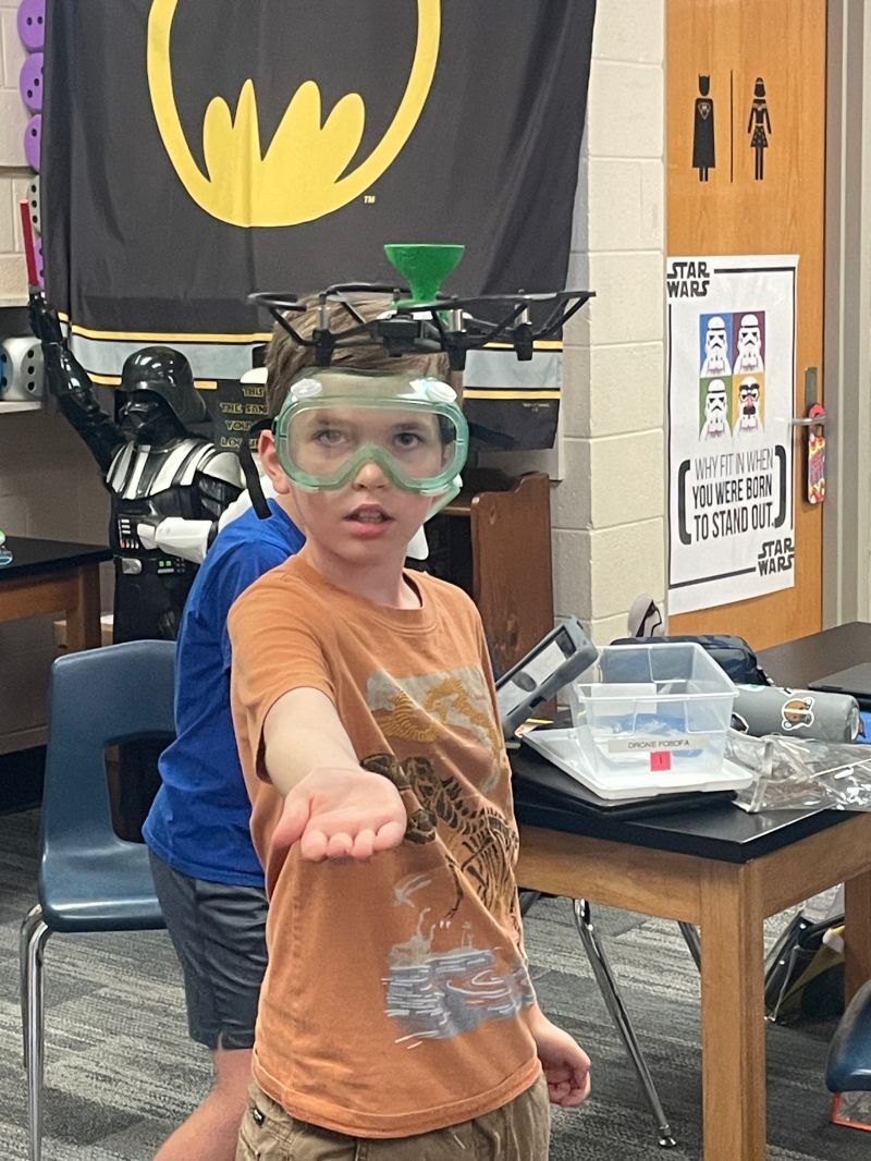
At Drone Legends, we’re excited to work with and inspire kids who will become the next generation of drone pilots. Our STEM programs stimulate kids’ imagination using hands-on tools and real-world applications.
We invite you to learn more about our programs and help us prepare kids to become the drone pilots of tomorrow.